WAEC Geography 2023 Theory — Question 7
Question 7 of 14 from the West African Examinations Council (WAEC) Geography 2023 Theory paper, with the correct answer and a full explanation.
Advertisement
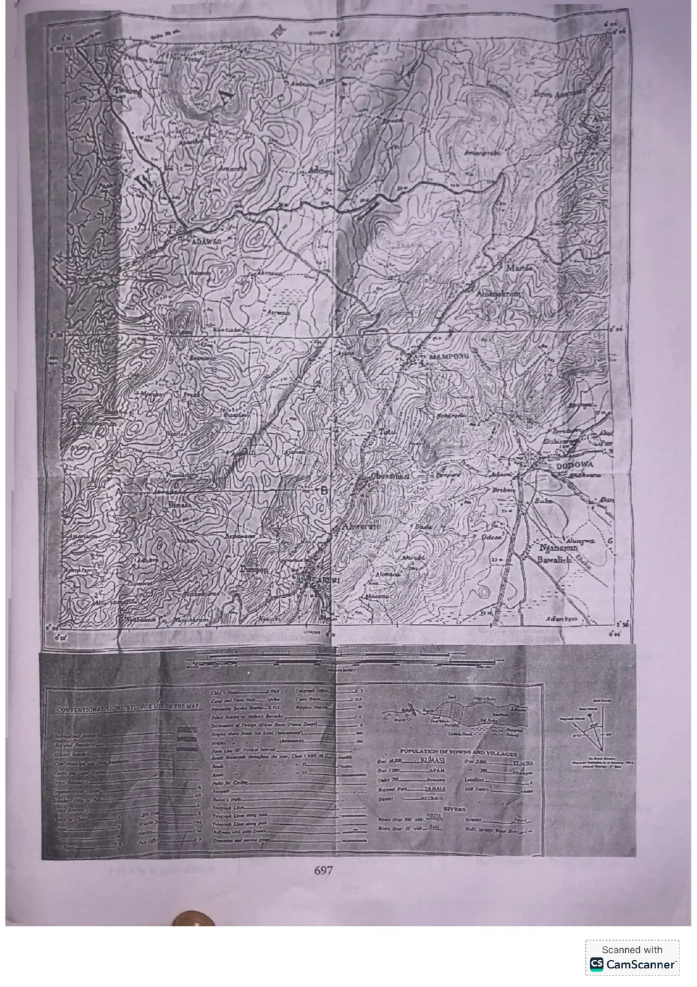
[Paper 3] 1. Study the attached topographical map extract (scale 1:50,000) and answer the questions that follow. (a) On the map extract, mark and name the following features using the letters given: (i) confluence (CF); (ii) steep slope (SS); (iii) ridge (RG); (iv) area liable to floods (LF); (v) spur (SP). (b) Calculate the gradient along the line A to B using the metric method of measurement. (c) Highlight three drainage characteristics of the mapped area.
Model answer
(a) On the topographical map extract shown: a confluence (CF) is marked where two or more rivers/streams meet; a steep slope (SS) is marked where contour lines are very close together; a ridge (RG) is marked along a narrow, elongated area of high land with parallel contour lines; an area liable to floods (LF) is marked on flat low-lying land close to a river course; a spur (SP) is marked where a highland projects into a river valley (V-shaped contours pointing away from high ground). (b) Gradient = Vertical Interval (difference in height between A and B) ÷ Horizontal Equivalent (actual ground distance between A and B, obtained by scaling the map distance using the given 1:50,000 scale). Gradient is then expressed as a ratio, e.g. 1: (Horizontal Equivalent ÷ Vertical Interval). (Exact figures depend on direct measurement from the attached map extract.) (c) Drainage characteristics of the mapped area typically include: the general direction of flow of the rivers/streams; the drainage pattern observed (e.g. dendritic, trellis, radial); and the density of streams (e.g. few or many tributaries) within the mapped area.
Advertisement
Sign up free to unlock
- Score tracking
- Practice history
- Saved questions
- Progress dashboard
- Personalized sessions
- Weak-topic breakdown
…and/or go further with premium services and No Ads.