All 14 questions from the West African Examinations Council (WAEC) Geography 2023 Theory paper, with the correct answer and a full explanation for each. Free, no signup needed.
[Paper 2] 1(a). Identify five problems affecting industrial growth in developing countries.
1(b). Suggest five measures that can promote the growth of industries in developing countries.
Model answer
(a) Problems affecting industrial growth in developing countries: poor quality of industrial labour; inadequate/shortage of raw materials; insufficient capital/high interest rate/difficulty in sourcing for funds; inadequate/erratic power supply; political instability/poor governance; competition from foreign goods; poor management; poor/inadequate transportation network; poor/inadequate communication network; inadequate skilled labour/manpower.
(b) Measures to promote industrial growth: local sourcing of raw materials; restructuring the educational system for technical knowledge/entrepreneurship; establishment of industrial development banks; stable government; active government participation; provision of adequate communication network; provision of adequate transportation network; local fabrication of spare parts; local fabrication of industrial machines; increased wages and salaries.
[Paper 2] 2(a). Outline five characteristics of rural settlements in Tropical Africa.
2(b). In what five ways does rural settlement depend on urban settlement?
Model answer
(a) Characteristics of rural settlements in Tropical Africa: low/sparse population; homogenous population; perform primary activities/functions; few or no social amenities; poor transportation network; poor communication network; no planned building layout; relatively free from waste disposal problems; mainly dispersed/nucleated/linear; simple and quiet lifestyle.
(b) Ways rural settlements depend on urban settlements: for manufactured goods, e.g. farm inputs; for market; for diffusion of ideas/innovation; as administrative headquarters; for employment; for capital flow-back; for information dissemination.
[Paper 2] 3. Describe rail transportation in Tropical Africa under the following headings:
(a) four advantages;
(b) three problems affecting rail transportation;
(c) one solution to each of the problems stated in 3(b).
Model answer
(a) Advantages of rail transportation: most suitable for transporting bulky goods; relatively cheap; can go long distances; helps to open up new lands/areas; has larger carrying capacity; relatively safe, e.g. fewer accidents/security; low cost of routine maintenance.
(b) Problems affecting rail transportation: inadequate/non-availability of spare parts/high cost of spare parts; inadequate capital/low budgetary allocation; low patronage, e.g. passengers, bulky goods; poor standard coaches; slow speed; poor management/planning/poor maintenance culture.
(c) Solutions to the problems in 3(b): fabrication of spare parts/importation of spare parts; refurbishing of coaches/standard uniform gauge and multiple tracks; publicity/advertisement, adequate capital/increased budgetary allocation, and training and retraining of personnel; buying new and modern coaches and improved management/monitoring and service delivery.
[Paper 2] 4(a). What is internal trade?
4(b). Outline five problems limiting internal trade in Nigeria.
4(c). Identify four importance of internal trade in Nigeria.
Model answer
(a) Internal trade is the buying and selling or exchange of goods and services within the borders of a country.
(b) Problems limiting internal trade in Nigeria: inadequate and poor transportation network; poor communication network; poor storage facilities/methods; low level of technology; smuggling; insecurity; unfavourable weather conditions affecting transportation of goods and services; artificial scarcity/hoarding of commodities; similarity of products; political instability/inter-communal or ethnic conflicts.
(c) Importance of internal trade in Nigeria: fosters regional cooperation/relationship; availability of new products; employment generation; growth of ancillary services; provision of raw materials; diffusion of ideas/innovations; source of revenue to government, e.g. taxes and levies; source of income; improved standard of living; appreciation of skilled expertise.
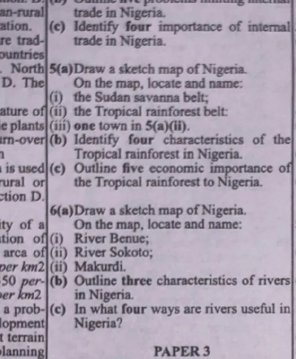
[Paper 2] 5(a). Draw a sketch map of Nigeria. On the map, locate and name: (i) the Sudan savanna belt; (ii) the Tropical rainforest belt; (iii) one town in 5(a)(ii).
5(b). Identify four characteristics of the Tropical rainforest in Nigeria.
5(c). Outline five economic importance of the Tropical rainforest to Nigeria.
Model answer
(a) On a sketch map of Nigeria: the Sudan savanna belt should be located and shaded across the northern part of the country; the Tropical rainforest belt should be located and shaded across the southern part of the country; a town within the rainforest belt should be marked, e.g. Ibadan, Benin, Ife or Calabar.
(b) Characteristics of the Tropical rainforest in Nigeria: trees with evergreen leaves; hardwood trees; trees with buttress roots; presence of lianas, epiphytes and saprophytes etc.; leaves are broad in nature; mixed species/trees not in pure stand; three layers of canopy; thick blanket/carpet of dead leaves; trees of about 40-60 metres (upper layer).
(c) Economic importance of the Tropical rainforest to Nigeria: provision of hardwood for construction; source of timber for export/foreign exchange; provides employment, e.g. lumbermen, forest guards, transporters etc.; hunting of wild animals for food; source of materials for building, e.g. palm branches/leaves etc.; serves as a tourist attraction, e.g. Ogba National Park (Benin); source of medicinal plants; raw materials for industries, e.g. boat building, sawmills, local craft industries etc.
[Paper 2] 6(a). Draw a sketch map of Nigeria. On the map, locate and name: (i) River Benue; (ii) River Sokoto; (iii) Makurdi.
6(b). Outline three characteristics of rivers in Nigeria.
6(c). In what four ways are rivers useful in Nigeria?
Model answer
(a) On a sketch map of Nigeria: River Benue should be located flowing from the northeast through Makurdi to join River Niger; River Sokoto should be located and marked in the northwest; the town of Makurdi should be marked at the confluence area on River Benue.
(b) Characteristics of rivers in Nigeria: seasonal fluctuation in volume; presence of rapids and waterfalls; short river courses; high speed/swift flowing; presence of debris; presence of water weeds, e.g. water hyacinth; specific direction of flow; shallowness; colour changes with season; valleys are narrow at the upper course.
(c) Ways rivers are useful in Nigeria: medium of transportation/navigation; source of water for agricultural purposes, e.g. irrigation, livestock watering; source of food, e.g. fish, crab, periwinkle; source of water for domestic use, e.g. washing, cooking, drinking; source of water for industrial use; site for tourist attraction, e.g. confluence points at Lokoja, Gurara Waterfall; generation of hydro-electric power, e.g. Kainji, Shiroro; employment generation, e.g. technicians, drivers, food vendors, fishermen; serves as natural boundaries, e.g. between states.
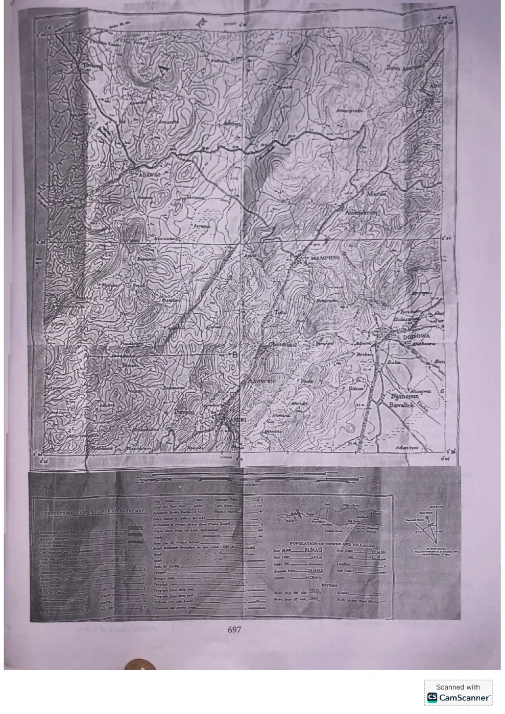
[Paper 3] 1. Study the attached topographical map extract (scale 1:50,000) and answer the questions that follow.
(a) On the map extract, mark and name the following features using the letters given: (i) confluence (CF); (ii) steep slope (SS); (iii) ridge (RG); (iv) area liable to floods (LF); (v) spur (SP).
(b) Calculate the gradient along the line A to B using the metric method of measurement.
(c) Highlight three drainage characteristics of the mapped area.
Model answer
(a) On the topographical map extract shown: a confluence (CF) is marked where two or more rivers/streams meet; a steep slope (SS) is marked where contour lines are very close together; a ridge (RG) is marked along a narrow, elongated area of high land with parallel contour lines; an area liable to floods (LF) is marked on flat low-lying land close to a river course; a spur (SP) is marked where a highland projects into a river valley (V-shaped contours pointing away from high ground).
(b) Gradient = Vertical Interval (difference in height between A and B) ÷ Horizontal Equivalent (actual ground distance between A and B, obtained by scaling the map distance using the given 1:50,000 scale). Gradient is then expressed as a ratio, e.g. 1: (Horizontal Equivalent ÷ Vertical Interval). (Exact figures depend on direct measurement from the attached map extract.)
(c) Drainage characteristics of the mapped area typically include: the general direction of flow of the rivers/streams; the drainage pattern observed (e.g. dendritic, trellis, radial); and the density of streams (e.g. few or many tributaries) within the mapped area.
[Paper 3] 2. The table shows the temperature and rainfall distribution of Station X. Study and use it to answer the questions.
(a) Identify the type of climate represented by Station X.
(b) From which hemisphere was the climatic figures taken? Support your answer with one reason.
(c) Outline four characteristics of the rainfall recorded at Station X.
(d) Calculate the mean annual temperature for Station X.
Model answer
(a) Station X represents the Tropical/Equatorial (rainforest) type of climate, since it shows consistently high temperatures throughout the year with rainfall in most months.
(b) The climatic figures were taken from the Northern Hemisphere. This is supported by the fact that the highest temperatures occur around the months of March–June (before the mid-year), consistent with the sun's overhead position moving north of the equator during this period.
(c) Characteristics of the rainfall at Station X: rainfall occurs in almost every month of the year (no long dry season); there is a period of heavier/peak rainfall around the middle of the year; total annual rainfall is high (typical of equatorial areas); rainfall is convectional in nature, often accompanied by thunderstorms.
(d) Mean annual temperature = (Sum of monthly temperatures) ÷ 12. Using the values in the table: (25+27+32+34+35+33+29+28+28+29+28+25)/12 = 353/12 ≈ 29.4°C.
[Paper 3] 3(a). List the four seasons of the year.
3(b). Outline two differences between standard time and local time.
3(c). With the aid of a diagram, describe the formation of solar eclipse.
Model answer
(a) The four seasons of the year: Spring, Summer, Autumn (Fall) and Winter.
(b) Differences between standard time and local time: (i) Standard time is the same uniform time observed throughout a country or time zone, while local time varies from place to place depending on longitude. (ii) Standard time is fixed by law/government for a whole region, while local time is based strictly on the actual position of the sun at a specific meridian.
(c) Formation of a solar eclipse: A solar eclipse occurs when the moon passes directly between the earth and the sun, so that the moon's shadow falls on the earth's surface, blocking out all or part of the sun's light from being seen at that location. This can only happen during a new moon, when the sun, moon and earth are aligned (in that order) in a straight line. The region on earth that falls within the moon's full shadow (umbra) experiences a total eclipse, while surrounding areas within the partial shadow (penumbra) experience a partial eclipse.
[Paper 3] 4(a). List: (i) three surface features of a limestone region; (ii) four underground features of a limestone region.
4(b). Outline four benefits of limestone region.
Model answer
(a)(i) Surface features of a limestone region: sink holes/swallow holes; limestone pavements; dry valleys; clints and grikes.
(ii) Underground features of a limestone region: caves/caverns; stalactites; stalagmites; underground streams/rivers; pillars (formed when a stalactite and stalagmite join).
(b) Benefits of a limestone region: source of raw material for cement production; source of building/construction material; tourist attraction, e.g. caves; source of employment through mining activities; used in the manufacture of lime for agriculture (soil treatment).
[Paper 3] 5(a). List three processes of river transportation.
5(b). State four characteristics associated with the middle course of a river.
5(c). With the aid of a diagram, describe the mode of formation of interlocking spurs.
Model answer
(a) Processes of river transportation: traction; saltation; suspension; solution.
(b) Characteristics of the middle course of a river: the river channel becomes wider than in the upper course; the velocity of flow reduces compared to the upper course; both erosion and deposition occur; meanders begin to form; the valley becomes broader with a flatter gradient.
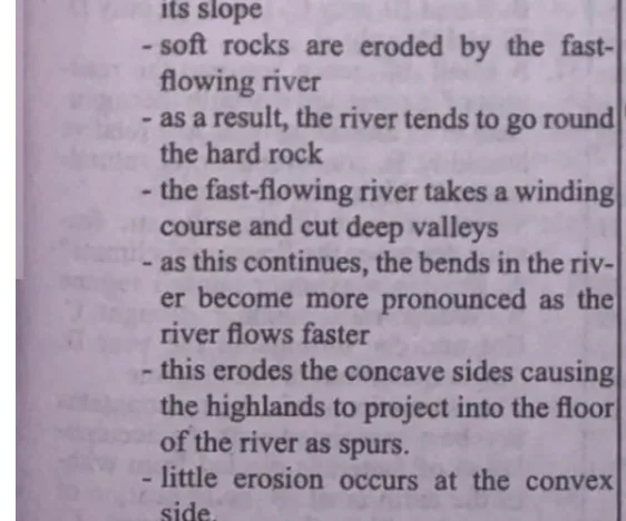
(c) Formation of interlocking spurs: Interlocking spurs are formed in the upper section of a river. There is the presence of a highland projecting into the course of the river with alternate bands of hard and soft rocks, and the presence of obstacles such as hard rocks. Vertical erosion dominates at this section, and the river meanders as it takes its course along the easiest path down its slope. Soft rocks are eroded by the fast-flowing river; as a result, the river tends to go round the hard rock. The fast-flowing river takes a winding course and cuts deep valleys; as this continues, the bends in the river become more pronounced as the river flows faster. This erodes the concave sides, causing the highlands to project into the floor of the river as spurs. Little erosion occurs at the convex side; materials eroded from the concave bank are deposited at the convex bank. Further erosion causes the alternate spurs on the bank to project into the concave banks of the river, which eventually interlock with each other to form features called interlocking spurs.
[Paper 3] 6(a). Define climate.
6(b). List five factors that affect climate.
6(c). Highlight four characteristics of Equatorial climate.
Model answer
(a) Climate is the average weather condition of an area taken over a long period of time, usually over 35 years.
(b) Factors that affect climate: latitude; altitude; continentality/distance from the sea; ocean currents; planetary winds/atmospheric circulation; slope and aspect; cloud cover; natural vegetation; soil; global warming.
(c) Characteristics of Equatorial climate: high temperature all year round; mean monthly temperature of about 27°C; small annual range of temperature (2°C–4°C); high humidity, with relative humidity of over 80%.
[Paper 3] 7(a). What is weathering?
7(b). Explain the following processes of mechanical weathering: (i) frost action; (ii) exfoliation.
Model answer
(a) Weathering is the gradual disintegration or decay of rocks in situ by chemical or mechanical processes.
(b)(i) Frost action: Also called frost wedging or freeze-thaw weathering, this takes place in mid-latitude and temperate regions (and can also occur in mountainous regions) that are subject to freezing. Water that has entered cracks in rocks freezes and expands, exerting pressure on the rock; repeated freezing and thawing widens the cracks until the rock breaks apart.
(ii) Exfoliation: This takes place in arid and semi-arid regions, where there is a big difference between daytime and night-time temperatures. As the rocks are heated during the daytime, the outer layers expand more than the interior; as they cool at night, the outer layers contract more than the interior. This continuous expansion and contraction produces stress on the outermost layer, which eventually causes the outer layer to peel/pull away from the rock in curved sheets/flakes.
[Paper 3] 8(a). What is solar energy?
8(b). Outline three advantages of solar energy.
8(c). Highlight three problems associated with harnessing of solar energy.
Model answer
(a) Solar energy is radiant energy from the sun which comes as heat and light and can be harnessed as an atmospheric resource.
(b) Advantages of solar energy: it is inexhaustible and renewable; it is abundant; it is entirely free; it provides energy independence; it provides heat energy in the environment; it provides light during the daytime.
(c) Problems associated with harnessing solar energy: it is not available at night or on cloudy/overcast days; the equipment/technology needed to harness it (solar panels) is expensive to install; it requires a large surface area for significant energy collection; energy storage (in batteries) for later use can be difficult and costly; efficiency can be affected by dust, weather and location.
Advertisement
Sign up free to unlock
Score tracking
Practice history
Saved questions
Progress dashboard
Personalized sessions
Weak-topic breakdown
…and/or go further with premium services and No Ads.